Do you believe your inland Georgia property is safe from flooding simply because it’s far from the ocean?
What if a single thunderstorm could cause tens of thousands of dollars in damage—without warning?
This article explores why flood insurance isn’t just for coastal residents in Georgia. You’ll learn the real scope of inland flood risk across the state, from Atlanta’s suburbs to Macon’s historic districts. We’ll cover:
- The widespread nature of inland flooding in Georgia
- Case studies illustrating real flood events
- The economic risks of going uninsured
- Flood insurance requirements and options
- Practical steps to assess and mitigate your flood exposure
The Hidden Truth About Flood Risk in Inland Georgia
Inland Flooding Is More Common Than You Think
Over 75% of Georgia’s counties—most of them far from the coast—have experienced floods severe enough to warrant federal disaster declarations. Alarmingly, 1 in 5 flood insurance claims in Georgia come from moderate- to low-risk areas.
The most common culprit? Thunderstorms. These weather events, not hurricanes, are the leading cause of floods in the state. With Georgia’s annual rainfall averaging between 45 and 75 inches, inland flooding can strike almost anywhere.
Georgia’s Topography Creates Unique Flood Hazards
From the mountains of North Georgia to the flat plains in the south, the state’s terrain contributes to different types of flood risks:
- North Georgia: Steep mountains funnel rainfall into rapid flash floods.
- Piedmont region: Rivers like the Ocmulgee overflow after sustained rainfall.
- South Georgia: Flat land and poor drainage result in slow, persistent floods.
Rivers, Runoff, and Interconnected Risks
Georgia’s 21 major rivers—including the Chattahoochee and Oconee—can create downstream flooding long after the rain has stopped. A storm in the mountains can cause floods in towns miles away days later.
Urbanization and Climate Change Amplify the Threat
Development increases impervious surfaces like concrete, which accelerates runoff. Cities such as Atlanta have seen flood risks spike due to this and the urban heat island effect. At the same time, climate change is bringing more intense storms, which means FEMA’s old flood maps might no longer reflect future realities.
Real Stories of Inland Flood Devastation
The 2009 Atlanta Floods: Widespread Damage
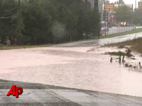
That same storm inundated 23 counties, caused $500 million in damages, and claimed 10 lives. These events show that distance from the ocean doesn’t mean safety from flooding.
Macon-Bibb County: The Inland Danger Zone
Macon-Bibb County, hundreds of miles from the coast, has nearly 8,600 properties at flood risk. First Street Foundation data reveals a ten-fold discrepancy between official FEMA risk zones and actual high-risk properties in the area.
Why Flood Insurance Still Matters—Even in “Low-Risk” Zones
FEMA Mapping Often Misses the Mark
FEMA flood maps don’t account for two-thirds of U.S. rivers, heavy rainfall events, or recent developments. In Atlanta, FEMA maps list 1,557 high-risk properties, while private models identify over 14,000.
What Lenders and Insurers Know That You May Not
Many private lenders now require flood insurance even outside FEMA flood zones. Why? Because their models consider real-world data like rainfall intensity, topography, and climate projections.
Understanding Flood Insurance: Requirements and Coverage Options
Who Needs It?
You’re required to have flood insurance if:
- You have a federally-backed mortgage
- Your property is in a Special Flood Hazard Area (Zone A, AE, etc.)
But even if you’re not required to carry it, your flood risk could still be significant.
Coverage Limits
- Residential: Up to $250,000 for buildings and $100,000 for contents
- Commercial: Up to $500,000 each for buildings and contents
Private flood insurance can offer higher limits and more flexible terms, including coverage for additional living expenses.
The Waiting Period Trap
NFIP policies take 30 days to activate—meaning you can’t wait until a storm hits to get covered.
How to Assess and Manage Your Flood Risk
Go Beyond the FEMA Map
Start with your FEMA zone, but also consult:
- Local floodplain managers
- Historical flood records
- Advanced tools like First Street Foundation’s Flood Factor
Evaluate Your Property’s Specific Risks
Check your elevation, proximity to water, and local drainage capacity. Poor drainage, hilly terrain, and nearby rivers all increase your flood exposure.
Improve Your Property’s Flood Resilience
- Grade land to direct water away from your home
- Install proper gutters and drainage systems
- Use flood-resistant building materials
- Raise utilities above base flood elevation
Have a Flood Emergency Plan
Include evacuation routes, a 72-hour emergency kit, an out-of-area contact person, and a digital inventory of your home and possessions.
Conclusion: Yes—Flood Insurance Is Essential for All Georgia Property Owners
Georgia’s inland regions are not safe from flooding. In fact, they are frequently hit by devastating events that upend lives and wipe out finances. Just because your property isn’t near the coast doesn’t mean it’s outside the reach of floodwaters.
Flood risks in inland Georgia are widespread, growing, and often underestimated due to outdated maps and assumptions. And the financial burden of flood recovery—often uncovered by homeowners insurance—can be overwhelming.
Now that you understand the reality of Georgia’s inland flood risks, take action to assess your exposure and get protected. Don’t wait for the next thunderstorm or hurricane remnant to find out the hard way.